Environmental scientists took to the waters last fall for the second year of a three-year initiative to map eelgrass in the Islands Trust area.
The study will provide baseline information that marine scientists and conservation organizations can use to monitor marine habitats of the Salish Sea (Strait of Georgia).
The project’s partners — the Islands Trust Fund, SeaChange Conservation Society, and Seagrass Conservation Working Group — released the results of that mapping this week.
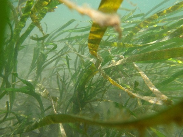
Eelgrass (Zostera marina) is a flowering marine plant that provides critical habitat to fish, shellfish, birds and mammals. Eelgrass meadows serve as nursery habitat, providing food and protection for over 80 per cent of the region’s commercially important fish and shellfish species at some point in their lifetimes.
Sometimes called “salmon highways," eelgrass habitat is essential to the survival of all species of salmon along our coast.
Eelgrass, also dubbed blue carbon, sequesters carbon at a much faster rate than the equivalent area of forest. When its contributions towards fisheries and carbon sequestration are taken into consideration, the plant can be considered to have a significant economic value.
“According to the David Suzuki Foundation, the estimated natural capital value of eelgrass is estimated to be between $21,000 and $80,000 per hectare per year,” says Kate Emmings, Ecosystem Protection Specialist with the Islands Trust Fund.
“If this was extrapolated to the estimated extent of eelgrass in B.C. — 40,000 hectares — that number would be somewhere between $1 billion and $3 billion per year.”
The areas the Islands Trust Fund and its partners have mapped so far include Denman, Hornby, the Ballenas-Winchelsea archipelago, Bowen, Gabriola, Galiano, Gambier, Lasqueti, Mayne, Pender and Thetis Local Trust Areas.
If enough funding is found for 2014, the Islands Trust Fund hopes to complete the mapping for Salt Spring and Saturna Island Local Trust Areas.
Eelgrass habitats are particularly sensitive to docks, mooring buoys and anchor chains, hardened shorelines, and contaminated or silty runoff from land.
The Islands Trust Fund aims to use the eelgrass mapping to focus voluntary conservation efforts on the shorelines and watersheds that have the greatest impact on eelgrass meadows. Local governments and island communities may also use the maps when considering community education programs, land use plans and development applications along the shoreline.
To view the mapping completed so far for the Islands Trust area or read the report, visit the Islands Trust Fund at www.islandstrustfund.bc.ca/initiatives/marineconservation/eelgrass-mapping.aspx.
Project funders included the Comox Valley Regional District, Islands Trust, the Pacific Salmon Foundation, the Victoria Foundation, Greater Victoria Savings and Credit Union, Capital Regional District and Metro Vancouver.
— Islands Trust Fund