BC Hydro is extending the high flow advisory for people to stay away from the Puntledge River through Jan. 15.
January has started off as the wettest in 40 years on record, at 300 per cent of normal. Water inflows into the reservoir have been significant but not too high given the freezing level hasn’t risen too much, so a good percentage of the precipitation has fallen as snow in the upper watershed.
The forecast is a bit drier over the next few days, but next week looks wet. Hydro is particularly watching a potential atmospheric river event that may hit Vancouver Island late Monday or Tuesday, with freezing levels potentially rising to around 2,000 metres causing snowmelt along with moderate to potentially heavy rainfall. Additional rounds of precipitation may follow later in the week. Much uncertainly remains given it’s four days out, and the storm may shift and evolve away from the area. Still, there looks to be more storm activity next week and continued significant water inflows into Comox Lake Reservoir.
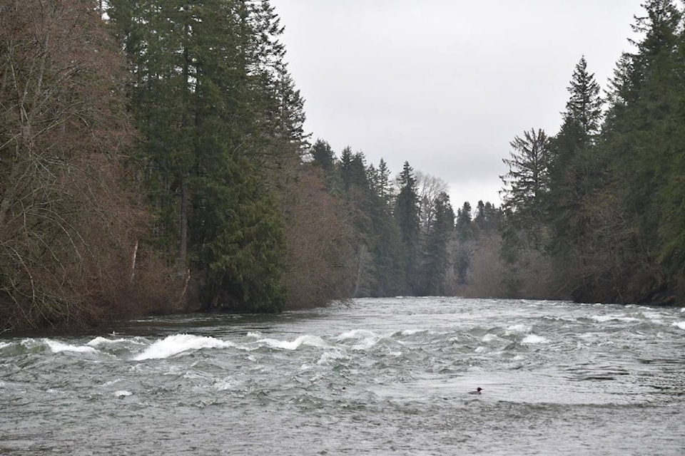
The discharges from Comox Dam down the Puntledge have ranged from about 40 cubic metres per second (m3/s) at high tide and about 90 m3/s at low tide. Normal seasonal discharges for this time year is around 30-40 m3/s. The King Tides will return on Tuesday through Sunday next week.
Hydro expects to maintain the release of about 90 m3/s through Jan. 15, though flows may go up to 110 m3/s at times, and may go down to 40 m3/s or so during the high tides. Flows will be high and fluctuating. There is a continued focus on public safety and the public staying away from the river, and this includes from areas where you could slip into the river.
The Tsolum and Browns rivers have reacted to the storms over the past week though have not risen to high levels as they have in the past.
The reservoir level rose about a metre since Hydro began spilling extra water on Dec. 31. The level is trending downward between storms and is currently at 134.1 metres. The reservoir should be well positioned by Sunday for the next round of possible storms.
If there is a change in the weather forecast, Hydro may adjust operations. If there is a significant change, another community update will be issued. Like all weather forecasts, there can be significant changes as systems track toward the West Coast and evolve.