Dear editor,
I would like to respond to some comments over the years, and most recently in paid advertisements in October, from people aligned with the Maple Pool campground that inaccurately claim BC Hydro played a role in the localized flooding in Courtenay in 2009 and 2010. It is time to say those comments are incorrect. We played a beneficial role in limiting the flooding. But first, some background.
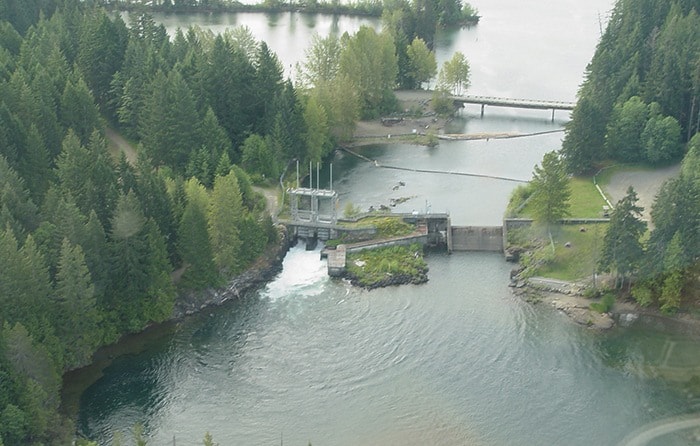
Water ultimately entering the Courtenay River includes water flows from the Puntledge, Browns and Tsolum rivers. There are also streams like Supply Creek, Morrison Creek and Arden Creek. Other than BC Hydro’s Comox Dam that can regulate releases down the Puntledge River, all of these rivers and creeks are naturally flowing.
At the 5th Street Bridge, and often backwatering to the Tsolum River and the campground area, localized flooding can begin at about 400 cubic metres per second (m3/s) of river flow along with high ocean tides.
Unfortunately, high ocean tides (king tides) occur in the fall/winter season. Very high tides, coupled with ocean storm surges from high winds that are often hand-in-hand with a large storm system, push water inland up the river estuary.
Pineapple Express storm systems originate from tropical zones and carry with them warmer temperatures and heavy rain. More recent weather terms call these systems atmospheric rivers. This is a double-whammy of heavy rain (100 mm per day) on top of snow melt. One such system in itself can cause flooding, but back-to-back systems are ill-fated for flood risk management – it’s simply too much water.
BC Hydro has meteorologists, hydrologists, senior engineers, biologists, facilities, shift engineers and community relations staff that co-ordinate and plan our operations 24/7. Our operations are well-planned for what we know at the time, based on stream flows and forecasted weather.
Our focus in storm events is dam safety and flood risk management. Water released from the Comox Dam takes about two hours to arrive at the Courtenay River, and we adjust discharges where possible up and down in consideration of ocean tides. In potential flood situations we work closely with Comox Valley emergency responders, and particularly the City of Courtenay.
Before, during and following those flood events we had one-two calls per day with them until the risk had ended. There was good communication and understanding.
When looking at the most recent flood event in January 2010, three storms hit in rapid succession over five days. Thankfully the third storm had freezing levels drop and most of the precipitation fell as snow. BC Hydro spilled water in advance of the storms and of course during and after the events.
The peak inflow into Comox Lake, during the second storm, hit over 1,000 m3/s A 1,000 m3/s flow rate can fill an Olympic-sized swimming pool in 2.5 seconds. During the entire series of storms, BC Hydro released downstream a range of 50 m3/s (high tide) to over 300 m3/s (low tide). Far more water was coming into the reservoir than going out. The reservoir rose two metres in about 36 hours as we held water back. For a reservoir analogy, the bathtub became full. The reservoir level peaked about one metre above the overflow spillway, and much of our operational flexibility was gone.
The Tsolum River hit about 250 m3/s twice in less than 24 hours and the Browns River reached 120 m3/s before the gauge was washed out by the flood flows. These naturally flowing rivers and streams, along with high oceans tides and storm surge, on their own can cause flooding as water moves out of the river banks.
Why has there been no significant flooding since January 2010?
The reason is the weather, and while we had some significant storms we were all able to manage through, particularly in late 2010, we have not been presented with very large events like January 2010. In addition, we went through a record dry period last fall and winter where there wasn’t one storm of any significance.
BC Hydro will do what we can to manage the Puntledge River system and we are spending millions of dollars starting in 2015 to improve numerous water gauges placed throughout the watershed that measure flow rates.
This will give us an even better understanding of the real time flow conditions and how we can consider them in our planned decisions. However, should the stars align where conditions outlined above take place with large storm systems, there will be localized downstream flooding.
BC Hydro can limit the flood impacts but we are unable to prevent flooding. BC Hydro will continue to operate during flood risk management situations within the full rights of our water licence.
Stephen Watson
BC Hydro