Derek Hayes collected stamps when he was a kid. But he wanted to know where they came from so dug out an atlas and fell in love with old maps.
He never dreamed that early childhood fascination would eventually lead to becoming an award-winning and bestselling author of 16 books.
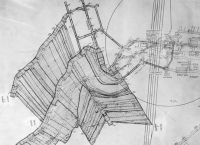
Hayes' most recent title, British Columbia, A New Historical Atlas, was recently released by Douglas & McIntyre. The 368 pages contain colour illustrations throughout. But the highlight is the more than 900 maps, two-thirds of which have never been published before.
And according to publicity materials, the Comox Valley, specifically Comox, Courtenay and Merville, is one of the largest sections in the book.
“The big story in the Comox Valley was coal mining, and there are many maps showing mines and settlements and railways,” Hayes said in an email interview. “There are maps of Cumberland as well as Union Bay where the coal was shipped out. The Cumberland Museum has enormous mine maps covering whole walls.”
The book also contains maps, photographs and images of notebooks and other items relating to various locations in the Comox Valley and B.C., as well as historical summaries and intriguing facts.
Hayes didn’t set out to be a writer.
A geographer by trade, he ran his own publishing and distributing business specializing in gardening books until 2001. He self-published his first book, Historical Atlas of British Columbia and the Pacific Northwest, in 1999. It did so well he changed careers.
“I always start by working out a timeline and storyline, determining what needs to be in a history of the place or subject,” he said. “Then I go looking for maps. They literally come from all over the world, archives, libraries, museums, private collectors.”
“For this book I also travelled around B.C. visiting every museum I could find,” he added. “It’s amazing what some smaller museum have in their collections. Especially mining maps and railway maps.
"British sources have much from the exploration and colonial eras, and Spanish archives have early Spanish explorations; the Hudson's Bay Company Archives in Winnipeg has fur trade era maps, the Land Title and Survey Authority has a treasure trove of maps in Victoria in a special vault still used by surveyors who need to go back to the first surveys to establish boundaries, etc.”
A press release notes that the British Columbia Historical Atlas uses maps made by early First Nation inhabitants, the Europeans who arrived to explore and exploit the province’s vast resource wealth and maps drawn by those who, decades later, prepared for war, built dams and tracked murders.
Hayes spent approximately 10 years researching, writing and compiling all the information for his latest book. So he’s definitely a man who loves his job.
Others do, too.
His first book sold more than 55,000 copies. And his numerous awards include the Bill Duthie Booksellers’ Choice Award, as well as the Lela Common Award for Canadian History from the Canadian Authors Association. Hayes’ next book will focus on railway pioneers around the world.
British Columbia, A New Historical Atlas retails for $59.95.
Paula Wild is a published author and regular contributor to the Comox Valley Record's arts and entertainment section.