Silviculture work dating back decades has aided Cumberland’s forested land today. The challenge now is to make sure the area is properly managed in future years.
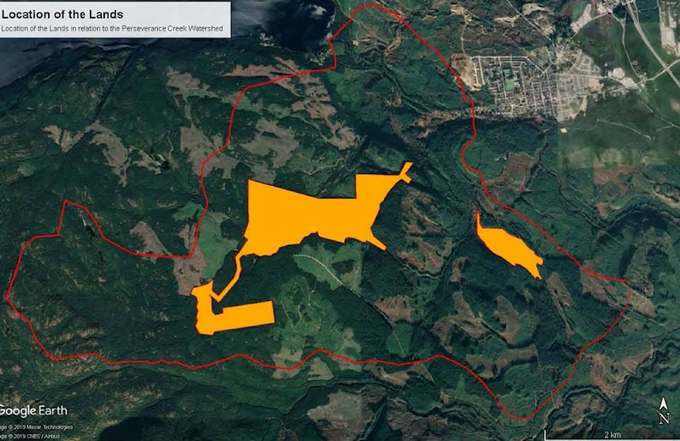
That’s one conclusion to be drawn from the first phase of land management planning process the Village of Cumberland is taking for its forest lands. The Village owns 230 hectares of forested lands in the upper Perseverance Creek watershed. The plan will help the community guide land management decisions in the future.
“They’re critical to the Village of Cumberland drinking water supply area and, of course, have some recreational amenities as well,” conservation biologist Tim Ennis of Latitude Conservation Solutions said of the lands in question.
At a council meeting in December, he presented baseline information outlining what exactly is on the Perseverance Creek lands and how this can inform future management inventories or management planning.
This is part of first phase of the plan, which revolves around information gathering, a process that has taken place over the past several months. It considers the history of the lands, current use, mapping and stakeholder identification, along with the baseline inventory. This information will inform future land planning for the area. Ennis focused on four subjects: ecological classification of zones; species at-risk observations; hydrology; and anthropogenic, or human-made features.
The land was purchased by the Village in 1950 from the Cumberland and Union Waterworks Company, and the natural integrity of the land is considered to be high. Through a silviculture program during the 1960s, some of the forested area was thinned to reduce density.
“We’re really, really lucky to have that legacy,” Ennis said.
Only about 14 hectares are covered by surface water, while about 4.5 hectares are covered by structures like roads or dams.
“Of the residual 211.5 hectares, 99.5 per cent of that land base is considered to be an ecological community that’s at risk in British Columbia,” Ennis said.
Upper elevations are dominated by submontane forest, which has diverse trees and shrubs that provide some climate resilience, whether conditions are wet or dry.
“All the ingredients are there to adapt,” he said.
At lower elevations, there is some old-growth forest but most is maturing second-growth. These areas are showing response to climate change such as dying Western red cedar.
Rock outcrops are also showing signs of drought as well as trampling from recreational use like hiking or mountain-biking.
As for wetlands in the forested area, there are many small sites, along with one large bog area, which provide habitat for diversity, as do riparian zones.
The natural world on site faces some threats. Ennis’s findings several at-risk species, including birds such as the common nighthawk, fish such as the coastal cutthroat, amphibians such as the western toad and northern red-leg frog, and mammals like the brown bat. In all, about 140 plants and 40 vertebrates were identified.
“You’ve got quite a suite of very important ecosystems,” he told council.
RELATED STORY: Bats could be key to mosquito battle in Comox Valley locations
In terms of the hydrology, the majority of land lies in the Village’s watersheds of Cumberland Creek and Perseverance Creek. About 28 per cent, however, lies in the Lookout Creek sub-watershed, which flows into Perseverance, though it is downstream of any water intake. As well, there are features such as bogs, creeks and wetlands considered valuable for drinking water quality and quantity.
As far as man-made effects, most land was logged from about 1890 to 1940, with second-growth forest replacing the original forest. There are seven dams and spillways, along with roads and trails.
“If it wasn’t natural, I mapped it,” Ennis said.
As far as conclusions, Ennis said the Village is lucky to have benefitted from silviculture work by the Village in the past to help future forests grow and protect the water supply.
“We really are indebted to them,” he said.
He recommended a full management plan or a direction statement, along with invasive species control in one area, devising a sediment or erosion control plan near the water supply, conducting an inventory for species at risk if any development is proposed for areas, tree thinning, self-imposed tighter land-use controls to protect water supply and adding land to support watershed protection initiatives.
A report to council notes a next phase of the land plan is engagement through outreach and discussions with stakeholders, developing a project website and the distribution of information to residents. The plan was to set up a comprehensive land management strategy. However, with limits on financial and human resources, staff are recommending the Village now move ahead with a less-detailed management direction statement (MDS). The current approach of managing the land primarily as a forest reserve, with low-impact recreation identified as a secondary use, would make up the underlying objective of this MDS.
READ MORE: Land access agreement reached Cumberland-area for forest lands
“It wouldn’t be a complete management plan,” Kevin McPhedran, Cumberland’s parks and recreation coordinator, told council. “It would recognize that we now have this baseline information to base future decisions on, so it would be basically like the framework of a management plan without the detail.”
In response, council passed a motion for staff to draft an MDS covering the forest lands, which will come back to council at a future meeting.
mike.chouinard@comoxvalleyrecord.com
Like us on Facebook and follow us on Twitter.