The Village of Cumberland has a new mission statement to protect its surrounding forests, which in turn protect its drinking water supply.
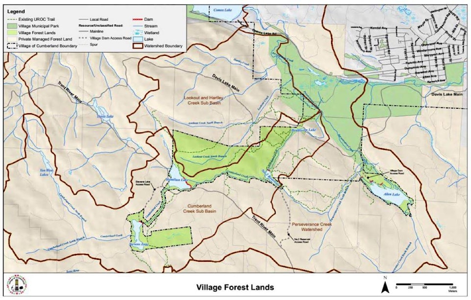
The village owns almost 230 hectares of surrounding forested land in the Perseverance Creek watershed. Staff have been looking into how the protect these lands in recent years, and at a meeting in late February presented council with a proposed management direction statement for the forest lands.
“The lands really exist as a forest reserve,” said Kevin McPhedran, Cumberland’s parks and recreation manager.
RELATED STORY: Cumberland looks to managing forest’s future
The purposed of the management direction statement is to provide a template for forest management actions and decisions. The management direction statement’s report lays out features in areas such as riparian zones, wetlands, uplands forests, rock outcrops and soils. It considers habitat for species at risk and other wildlife. It also includes indicators of negative effects and methods of avoiding problems as well as mitigation measures. The statement formalizes much of what is happening on the lands, with some updates to current practices. The statement report runs more than 20 pages and provides guidelines in lieu of a full management plan, which includes more detail and would require greater resources.
“This report is a really valuable asset,” Coun. Sean Sullivan said.
During the discussion, Coun. Gwyn Sproule said she would like to see a full forest management plan at some point but thought the statement was a good start.
“I’m pleased to see that we do have an outline of a plan here,” she said.
Council voted to adopt the management direction statement.
While primarily to preserve habitat and water sources, the forest lands are also used for non-motorized recreation, such a bike riders and runners. Under a current agreement, the United Riders of Cumberland maintain the area, which is not officially a park or part of any acquisitions of land led by the Cumberland Community Forest Society. McPhedran said those lands would be subject to their own upcoming planning process.
In response to a question about whether the strategy was connected to a regional district plan for an adjacent area of Perseverance Creek, McPhedran told council Cumberland’s strategy was not unrelated but was a separate process and covered only the village-owned area. The forest lands, southwest of Cumberland, were aided in part by silviculture work from decades earlier and purchased by the village starting in the 1950s.
Council had endorsed starting the forest management strategy process in late 2018, and as an initial step, a baseline inventory assessment of the area, particularly of species at risk, was conducted and presented to council by consultant Tim Ennis at the end of 2019. The topic of at-risk species and habitat mitigation came up at the recent meeting, as some on council had concerns over events in the area and potential effects on the ecosystem.
When asked about trail use for activities such as races, McPhedran responded that in those cases, event organizers can be held accountable for actions of participants.
“It’s the day-to-day use that is more challenging,” he added.
mike.chouinard@comoxvalleyrecord.com
Like us on Facebook and follow us on Twitter.